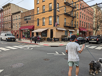
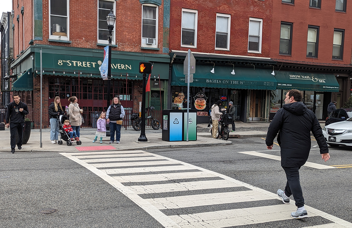
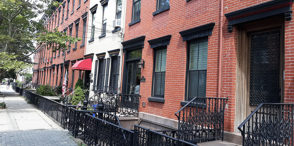
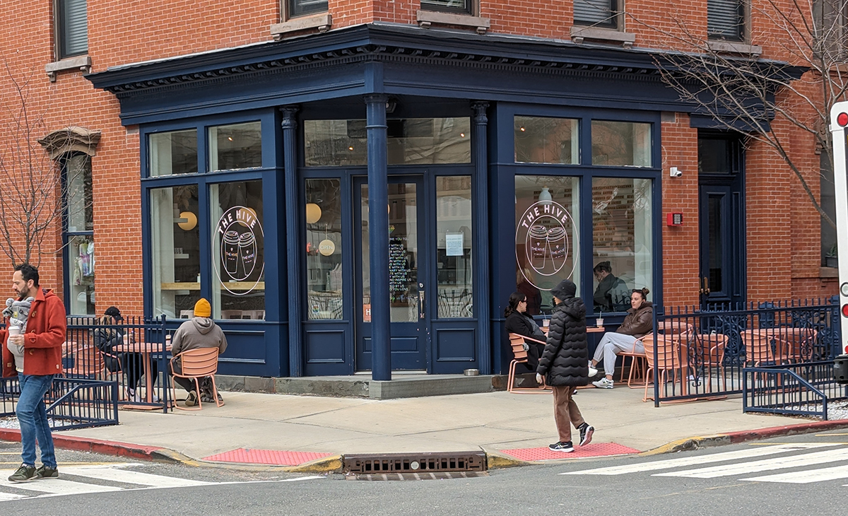
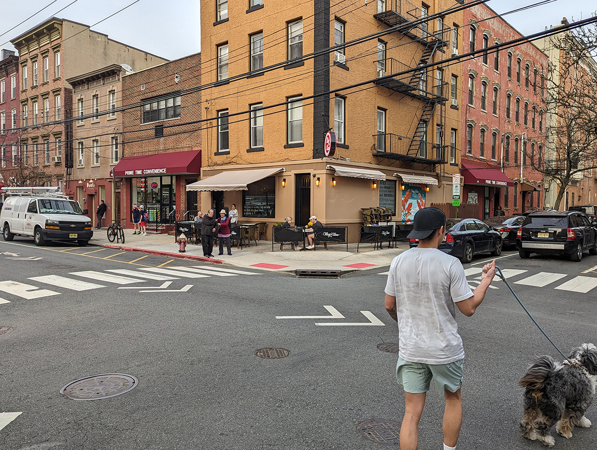
A mix of residential and retail uses, high densities, small lot sizes, and rows of buildings hugging front lot lines all contribute to lively, walkable neighborhoods
Hoboken Street Life – Slide 1: Eighth and Washington Streets; Slide 2: Bloomfield Street; Slide 3: Corner coffee shop 10th & Park; Slide 4: Third Street & Willow Avenue
FBW | April 10, 2024
Hoboken has been dubbed the “miracle mile.” With over 60,000 residents within its 1.25-square-mile land area, it is the fourth most densely populated city in the United States. Yet the 3 to 5-story walkup residential buildings, built more than 100 years earlier, impart a human scale.
The lively character of this Hudson River community originates in Col. Stevens’ 1804 plan for the city. By 1900, this clearly defined street grid had been extended to Hoboken’s western and northern borders. The resulting blocks are typically 200 feet wide and 420 feet long. These blocks are divided into narrow lots mostly measuring 25 feet wide and 100 feet deep. The buildings were built to the front lot lines facing the street, covering the front 50 percent of the lot.
Based on this 200-year-old plan, rows of buildings face the perimeter of each block reflecting a variety of architectural styles. Some blocks are lined with brick buildings, others with brownstones, many restored by their new owners. Where some old buildings have failed, they have been replaced with new, more modern structures. These “in-fill” projects correspond to Hoboken’s character by conforming to the small lot sizes, prevailing building heights and front lot alignments.
Mixed uses are interspersed throughout the city. Need groceries? A cup of coffee? A walk in a park? Going out to eat? All are within easy walking distance. The same is true if you are catching a bus, train, light rail or ferry to get to work. In fact, 56 percent of Hoboken’s working population commutes to work via public transportation.
Front doors and windows facing the street as well as frequent storefronts make for Hoboken’s lively streetscape. Most of Hoboken was built before the advent of cars, thus the older buildings have no on-site parking. The R-1 zoning district eliminates parking requirements and prohibits ground-floor parking, thus preserving the front doors and windows at street level.
Hoboken’s narrow one-way streets were mapped during the horse and buggy era. But today, these streets still work. With parking on both sides of the street, traffic is forced to slow down, making the town more pedestrian-friendly. The “parking problem” in Hoboken provides an additional incentive to walk.
Washington Street, a mile-long commercial strip, spans the length of town. The continuous row of small-scale shops and eateries at the base of residential buildings is like a traditional downtown business district. Many of these shops are locally owned and operated. The street’s wide sidewalks are filled with people during the day and into the evening hours.
For decades, benign neglect helped to preserve much of what is good about Hoboken. But beginning sixty years ago, there are examples of ill-conceived projects that contradict Hoboken’s urban village character. Two 1960s projects, Church Towers and Marine View Towers, represent the failed “tower-in-the-park”concept. Hudson Square North and South have front doors facing interior courtyards and blank walls facing River Street. New waterfront projects contain one or several massive buildings filling up entire blocks, in contrast to the many buildings per block throughout the rest of Hoboken. Today, the City of Hoboken is repeating this blunder at its North End Redevelopment Area between 15th and 16th Streets by erasing the lot lines established 100 years earlier.
Fortunately, Hoboken has preserved its traditional street grid, and beginning in the 1990s, extended it to the waterfront. The last street, Sinatra Drive, ensures that front doors and windows face the street, and also the new waterfront park that is nearing completion. Parking at the interior of the new blocks is shielded behind ground floor retail and residential uses. Most of Hoboken’s east-west streets lead directly to the Hudson River and the continuous park at the water’s edge.
Related Links
Hoboken’s private, lifeless alleyways are an ill-conceived attempt to create public space
Who needs a car in Hoboken, the ultimate 15-minute city?
Lot size matters
Streetscapes: Dead or Alive
What Hoboken can teach us about the principles of New Urbanism
The Mapping of Urban America
Hoboken’s original plan and first parks established in 1804
A model for the North End: Hoboken’s own historic urban village
A Plan for the Hoboken Waterfront


