Recent development trends contradict what has made the “miracle mile” a special place
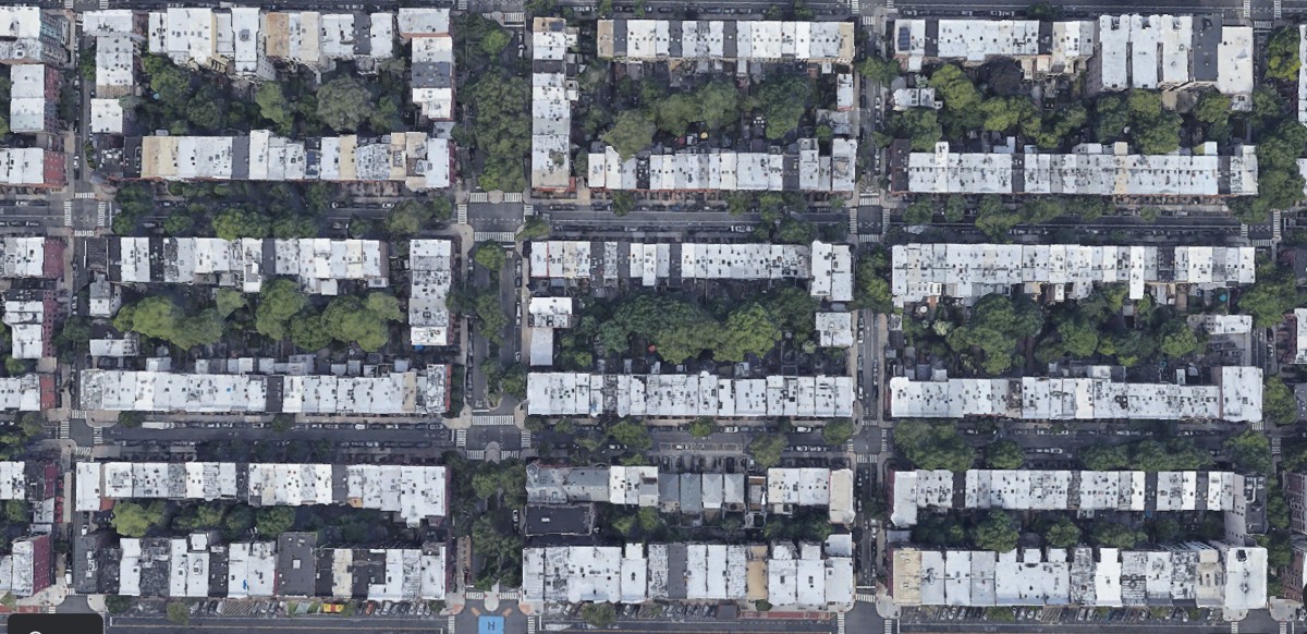
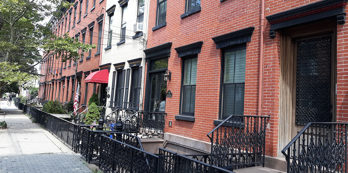
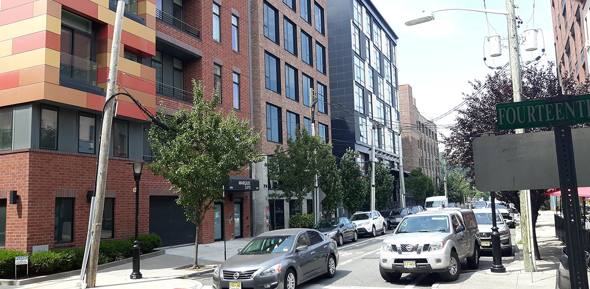
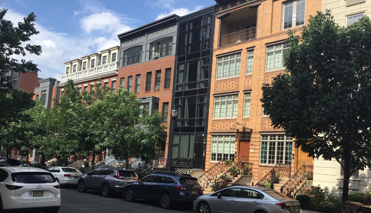
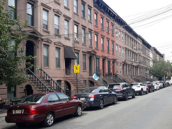
Image 1: Traditional Hoboken development with many lots/buildings facing perimeter of blocks.
Image 2: Row of brick homes lining Bloomfield Street, Hoboken.
Image 3: Hopkins plat map of 1909 at north Hoboken.
Image 4: Infill Development District in Hoboken’s North End Redevelopment Area.
Image 5: New development at Liberty Harbor North in Jersey City.
FBW | July 29, 2022
Hoboken, like so many other urban communities, was initially mapped and platted more than 200 years ago. Its uniform street grid and small lot sizes shaped the town’s development, mostly during the turn of the 20th century. The traditional street layout, intact with rows of brick and brownstone buildings preserved, has made Hoboken a special place, a lively and vital urban village.
In the 1970s, Hoboken’s revival began. Bargain prices as well as the turn-of-the-century charm attracted families who acquired and renovated the brick and brownstone buildings. Soon, developers were buying and upgrading multi-unit buildings. Where empty lots existed, new structures were built. Initially, the zoning code ensured that most of these new buildings conformed to the traditional standards: buildings covering 50 percent of the lot, facing the front lot line, built to five stories or less.
In the 1990s, the traditional street grid was extended to the waterfront thus creating typical Hoboken-sized blocks and well defined public right-of-ways.
But in a radical departure from the past, each of these new blocks consisted of just one lot. As a result, each block consisted of one or several buildings built by a single developer.
Last year, Hoboken adopted a redevelopment plan for the North End, the area north of 14th Street and west of Willow Avenue. Although the original lot lines that were established around 1900 still existed, the City Council adopted a redevelopment ordinance that eliminated these smaller lot sizes, thus opening the door for developers to potentially build massive structures filling up entire blocks.
Infill development is the process of developing vacant parcels on blocks that are already largely developed. This type of development has taken place throughout Hoboken proving that developers find it profitable to build smaller projects, on smaller lots. In fact, The North End Redevelopment Plan includes an “Infill Development District” where new projects have been springing up on lots measuring 65 to 100 feet in width. The blocks in this district reflect the variety and scale more reminiscent of Hoboken blocks built a century earlier.
Liberty Harbor North in Jersey City is another example of new development that has followed the model of a traditional public street grid with multiple buildings per block, facing the front lot lines.
Hoboken and other urban communities have relied increasingly on redevelopment plans rather than traditional zoning. This has led to poorly planned areas with ill-defined development parcels. The projects are often limited by a poor understanding of basic principles of urban design.
Typically, the redevelopment projects are shaped through a negotiation process between the City and the developer where the City is incentivized to offer greater heights and densities in exchange for greater benefits to the City. The North End Redevelopment Plan, for instance, offers taller buildings with more units in exchange for “give backs” such as a municipal public works garage, a public library branch, a community center with a swimming pool and a new light rail station.
Current planning and development decisions will greatly impact our future. It is essential for our elected representatives and city officials to understand the lessons of the town’s development in an earlier era which has made Hoboken, the “miracle mile,” such a successful community.
Related Links
A model for the North End redevelopment: Hoboken’s own historic urban village
Urban design flaws afflict North End Plan
Liberty Harbor North based on tenets of new urbanism
The urban design principles that make for successful waterfronts
Hoboken’s original plan and first parks established in 1804