Completing the park at Union Dry Dock must include a pedestrian & bicycle-friendly Sinatra Drive
by Nicole Teitler | FBW | July 17, 2021
The annual City of Water Day celebrates all that we, Fund for a Better Waterfront (FBW) and the Hoboken community, have accomplished. Since the 1990s, FBW’s mission has been to make the Hoboken waterfront accessible to all. This year we collectively found reason to celebrate a milestone success— the acquisition of the Union Dry Dock that will connect Castle Point Park to Maxwell Place Park. Our vision is to create a passive park, open space with shade trees and possibly a living shoreline with natural native plants. And while this is a celebratory moment, our mission isn’t complete just yet.
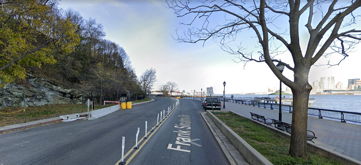
Hoboken’s original city layout was developed over 200 years ago in the early 1800s as a uniform, clearly defined street grid. Fast forward to modern day, as New Jersey’s Hudson River waterfront was being developed FBW’s urban planner, Craig Whitaker, stressed the importance of extending the urban street grid to the waterfront. Today, it’s what distinguishes Hoboken from all other Hudson River waterfront municipalities which failed to do this. The east-west streets from Newark Street to 4th Street and 11th Street to 15th Street all lead directly to the waterfront. Sinatra Drive clearly divides Hoboken’s public waterfront park from the upland blocks of private development. It has come a long way since. However, it still has a ways to go.
The goal of FBW is to create a continuous public waterfront park from the Hoboken Terminal to the Weehawken border. Year by year, we’ve pieced this together and implemented the basic planning principles to make Hoboken a unique place to visit and live. The key is keeping it all connected and maintaining a standard we can all be proud of. But there’s a major missing link to this part of the Hoboken cityscape, the central waterfront between 4th street and 11th street. There is a tremendous opportunity to complete this mission, and the reason why we keep fighting to apply the same standard to the central waterfront as we have to the south. FBW aims for a uniform standard that we can all be proud of.
Castle Point
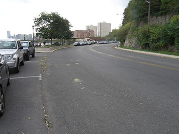
Castle Point, while it has an accessible pathway, presents a number of problems. The stretch of Sinatra Drive acts as a bypass road with a wider street that encourages faster traffic. If we narrow the street, which is over 50ft wide, it slows traffic and creates a calming effect on the waterway.
We propose:
- Two 11 foot traffic lanes
- One 8 foot parking lane
- A protective bike lane that continues after 4th Street and connects to 11th Street
- Plant rows of shade trees, similar to the canopy of the south waterfront, spaced every 20 feet
Stevens Waterfront: The last piece of the waterfront
Over the years, FBW has been critical of various proposals put forth by Stevens Institute of Technology including a massive parking garage facing Sinatra Drive between 5th and 6th Streets. Stevens responded by proposing a smaller garage that eventually will be wrapped with academic facilities. FBW has also proposed continuing the waterfront park where Stevens currently has unsightly surface parking, an issue yet unresolved despite the City’s recent upzoning of the campus.
The Restoration of Stevens Park
The last unfinished portion of the central waterfront between 4th and 5th Street is all city-owned and includes Stevens Park and the Little League Field. FBW has proposed restoring the original boundaries of the park that would allow 4th and 5th Streets to come directly to Sinatra Drive, thus making for safer intersections and also creating more public open space. All the connections of the streets, bike path and linear park would then be properly aligned.
A waterfront for everyone
The largest amount of urban space are the streets and sidewalks, the pathways to navigate a city. No one questions your right to be on these public right-of-ways— streets are also the line in the sand separating public and private space.
Therein, by extending all streets to the waterfront we give everyone the right to access it. Without these extended streets it gives a sense of privacy, that the land is owned by private development or entities, even though it remains public domain.
FBW’s mission is that those in the area and region at large are able to enjoy the Hudson River waterfront. It belongs to you. The public. That’s the way it was designed.
Related Links
With rows of shade trees, Hoboken’s South Waterfront is a model for trees in urban design
Landscape design for Columbus Park still shines 108 years later
The morning after Superstorm Sandy: Hoboken’s waterfront parks
Public parks provide essential benefits
Col. Stevens vision for Hoboken still valid 200 years later
Editorial: A Once-in-a-century Opportunity
Plan for the Hoboken Waterfont
Hoboken’s first parks established in 1804
Roots over the river