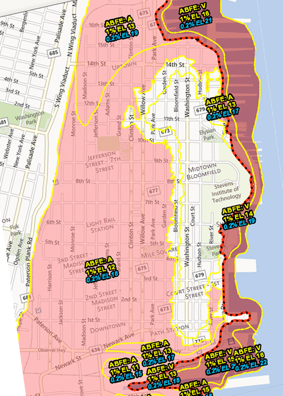
The following is a collection of maps and tools that can be used for floodplain analysis, determining flood insurance requirements, or predicting storm surge. Included within this collection are federally produced maps including FEMA’s Advisory Base Flood Elevations map (which was adopted, per emergency rule, by the New Jersey’s Department of Environmental Protection) in addition to open-source tools like Surging Seas’ storm surge analysis and WNYC’s predicted vs. actual Sandy flood maps.
Advisory Base Flood Elevations Map (ABFEs) — FEMA Coastal Analysis and Mapping
Predicted vs. Actual Flooding — WNYC
Sea Level Rise Analysis: Hoboken — Surging Seas
Storm Surge Overview — NOAA
Coastal Services Center: Digital Coast — NOAA
Hurricane Sandy Impact Analysis — FEMA MOTF
Hurricane Sandy GIS Resources — New Jersey Office of GIS
Google Crisis Map — Google Maps
Elevation and Population Density — Data Pointed
Communities Participating in NFIP’s Community Rating System — USA Today
NJDEP GIS — NJ Department of Environmental Protection


