By Steve Spinello | FBW | June 18, 2013
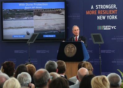
On June 11, New York City’s Mayor Michael Bloomberg announced the details of an ambitious $19.5B storm mitigation plan coming on the heels of hurricane season, which officially started June 1. The administration’s plan, titled “A Stronger, More Resilient New York”, includes a 438-page report with more than 250 specific recommendations culling knowledge and expert advice from a special task force created in the wake of superstorm Sandy. The task force consisted of experts from a variety of fields including climate scientists and engineers, healthcare practitioners, telecommunications, utilities, and insurance specialists. Bloomberg described the plan as “incredibly ambitious” and suggested that his administration will use its remaining days in office to begin implementation.
Predicting more extreme weather and an increasingly turbulent climate, Bloomberg acknowledged that “future storms could be even worse.” Rising temperatures and sea levels could contribute to a more dangerous and destructive storm than Sandy. Nearing the end of his final term as mayor, Bloomberg warned that extreme weather events will not be limited to tropical storms. “We have to look ahead and anticipate any and all future threats… droughts, heavy downpours and heat waves, which may be longer, and more intense, in the years to come” the mayor said.
Bloomberg’s remarks mirrored the contents of the plan which suggests that Sandy, although significant by historical standards, was not as bad as it could have been. The report notes that “While Sandy was historic, it was not, in fact, a worst-case scenario for all of New York City. As the climate changes… the risks that New York City faces will only intensify.” The mayor suggested that up to one-quarter of New York City’s land area, an area encompassing 800,000 residents, will fall within the floodplain by 2050. By then, more than 40 miles of the City’s waterfront could experience regular flooding.
The plan includes an extensive list of flood-mitigation strategies and emergency preparedness measures some of which were openly discussed in the immediate aftermath of Sandy. In particular, the report includes a specific section entitled “Coastal Protection” that outlines a series of measures aimed at mitigating the impact of Atlantic-borne storms. Stating that no single measure is sufficient to prevent storm-induced tidal surge, the authors’ recommendations suggest that the “right approach to coastal protection is an integrated system of discrete coastal projects” and a “multi-layered approach involving resiliency measures for buildings and protections for critical infrastructure.”
By encompassing all of the five boroughs, the plan’s authors acknowledge the fact that every shoreline is unique with distinct geologic and hydrological features. This was made evident during Sandy as a large part of the city’s storm fatalities were recorded on Staten Island’s south shore. There, a violent storm surge took on greater magnitude than in other parts of the city where flooding was although still significant much more gradual. Importantly, the plan makes use of accurate and relevant data. Citing the use of “sophisticated storm surge modeling” and “digital hydrodynamic models”, the report’s recommendations for measures like floodwalls and levees are the result of careful deliberation and comprehensive analysis.
Also included within the report are initiatives aimed at managing and equipping the city’s waterfront. “Initiatve 29” aims to “implement citywide waterfront inspections to better manage the City’s waterfront and coastal assets.” The initiative would include a centralized waterfront inspection program that would apply a uniform set of standards for all inspections while updating inspection guidelines to better account for flood-mitigation measures. “Initiative 35” will “enhance waterfront construction oversight by strengthening the City’s waterfront permit and dockmaster units” presumably a commitment to stricter enforcement of new or future development projects along the waterfront.
The report acknowledges that New York City alone will not be able to implement all of the measures included within the plan unless additional sources of financing are secured. The plan proposes forging long-term partnerships with the federal government, especially through the Army Corps of Engineers, and through other “regional stakeholders and governmental entities.” While initial funding will stem from money allocated to the city via federal Sandy relief legislation, future cost overruns will likely force the city to identify additional financing mechanisms – public or private. Despite these financial constraints and notwithstanding political barriers, the Bloomberg administration has shifted the conversation away from idea generation to deliverables. The mayor’s last 100+ days in office will be a strong indicator of how much of the plan gets off the ground.
Related Links
PlaNYC – “A Stronger, More Resilient New York”
Mayor Zimmer Announces Infrastructure Initiatives – City of Hoboken
Utilizing polders as flood mitigation measure
A serious conversation about Sandy
Dutch Dialogues: A model for Hoboken
Flood insurance rates will skyrocket
Monarch Towers now in FEMA’s High Hazard Zone
79% of Hoboken falls into FEMA’s flood zone
Post Sandy: After repairing the damage, then what?
12-Point Plan in preparation for the next Sandy