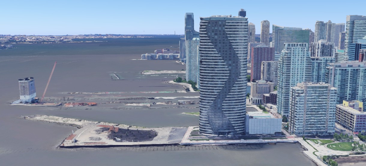
Photo 1: The newly built Ellipse, a luxury residential 44-story tower, on a pier at Jersey City’s Newport waterfront.
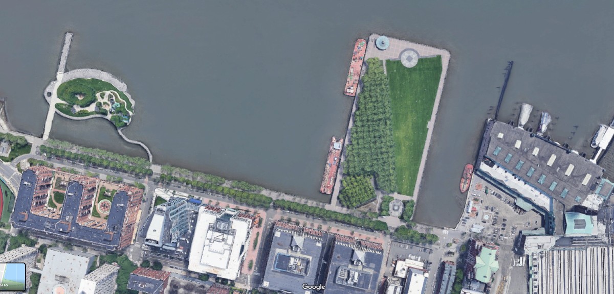
Photo 2: Bird-eye view of Hoboken’s South Waterfront with a waterfront park clearly delineated from upland blocks of private development by last north-south street.
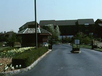
Photo 3: Private gated community at North Bergen’s Hudson River waterfront.
FBW | July 3, 2020
On June 22, the Jersey Journal front page headline read, “Jersey City’s waterfront could get a new park, but you might not be allowed in.” The LeFrak Organization had designed a 3.5 acre park reserved primarily for Newport residents near its new upscale residential tower, the Ellipse. The development of Newport, covering a 600-acre portion of Jersey City’s Hudson River waterfront, began in 1986 by real estate tycoon Samuel J. LeFrak who passed away in 2003.
This proposal by the LeFrak Organization is emblematic of how much of New Jersey’s Hudson River waterfront has been developed over the past 30 years. Most of the streets are private, not public. Most of the open space, except for the state-mandated 30-foot waterfront walkway, is private. In North Bergen and Edgewater there are a series of gated communities lining the waterfront. Residential and commercial buildings are built as close to the water’s edge as possible, abutting the waterfront walkway. Some projects are built on piers, over the Hudson River, effectively privatizing those spaces. Private developers have driven the planning process.
This problem is not confined to New Jersey’s Hudson River waterfront. After World War II, across the country, developers began initiating projects over large tracts of land. Planned unit developments (PUDs) have, in effect, institutionalized the practice of privatizing the planning process. Incorporated into local zoning ordinances, PUDs give developers the extraordinary latitude to come forward with their own proposals for lot layouts and street patterns on any large parcel of land.
Municipalities have always had the power to map and plat, thus determining the layout for streets, defining the size of development parcels and where public spaces will be located. From the beginning, this is how American cities developed. Classic examples are William Penn’s 1681 plan for Philadelphia, Pennsylvania; James Oglethorpe’s 1733 plan for Savannah, Georgia and the Commissioner’s Plan of 1811 for Manhattan. Col. John Stevens hired the surveyor Charles Loss to create Hoboken’s original plan in 1804. These plans guided the future growth of each city, establishing a uniform street grid long before the last parcels were developed.
Referendums in 1990 and 1992 changed the course of waterfront development in Hoboken. In both referendums, voters defeated development agreements between the City of Hoboken and the Port Authority of New York and New Jersey for the South Waterfront. After the 1990 vote, the Fund for a Better Waterfront (FBW), a nonprofit organization, was formed with the purpose of creating a plan for the Hoboken waterfront. FBW hired architect and planner Craig Whitaker who advised extending Hoboken’s public street grid to the waterfront and reserving the land on the river-side of Sinatra Drive, the last street, for a continuous public park. Sinatra Drive sets a clear line of demarcation between the public park and the upland private development.
Through 30 years of advocacy, FBW has shaped the development of Hoboken’s waterfront based largely on its 1990 plan. As a result, Hoboken’s waterfront development rather than being guided primarily by private interests, has been shaped with the public’s interest in mind.
The State of New Jersey, beginning in the late 1980s, required all developers building at the Hudson River waterfront to construct a 30-foot public walkway as a condition of being granted a waterfront permit. Most of this walkway has now been built, but access is sometimes limited due to the lack of a street grid to provide the public right-of-way connections to access the waterfront. In addition, the public nature of the walkway is diminished due to the adjacent private development. There is no clear delineation between the private and public space at the waterfront. In Hoboken, when one crosses Sinatra Drive to the waterfront park, there is no question you have entered the public realm, a public park.
The private streets at the Hudson River waterfront have created other problems. During recent Weehawken Planning Board hearings for a Hartz Mountain project at Lincoln Harbor, Mayor Turner repeatedly raised the issue of the inability of the public to park on the street. Hartz first began its Lincoln Harbor project over 30 years ago. The Board required Hartz to provide public parking spaces on some of its private streets as a condition of its recent approval for this project at the Weehawken Cove.
At Newport, the LeFrak Organization, not the City of Jersey City, collects parking meter revenue on its private streets. This occurs despite the fact that LeFrak’s Newport development was jump-started with a $40 million federal urban development grant and has continued to receive tax breaks over the years.
All along the Hudson River waterfront, including in Hoboken, large developers have exerted tremendous influence on how zoning laws and redevelopment plans are written. Among Samuel LeFrak’s memorable quotes is, “I believe in the golden rule. He has got the gold makes the rules.”