By Ron Hine | FBW | September 4, 2013
Hoboken has been called the “miracle mile-square city” for its many positive urban attributes. Hoboken is eminently walkable. The turn-of-the-century architecture has been remarkably well-preserved within a clearly defined street grid. The town is densely populated with over 50,000 people yet has maintained its human scale. Washington Street, also known as “the Avenue,” is a thriving mile-long commercial center filled with people throughout the day who enjoy the countless small-scale shops, restaurants and bars, many of which are home-grown. Hoboken is also a transit hub with 56% of its working population (ranking highest among the nation’s cities) taking public transportation to work via ferry, train, light rail or bus.
Hoboken has been defined primarily by its Hudson River waterfront,with some of the best views of the New York City skyline. Its western border sits at the base of the Palisades Cliffs. The south end of town is clearly defined by the train tracks leading to the historic Hoboken Train Terminal. To the north sits the Weehawken Cove and Lincoln Tunnel.
Hoboken, once a gritty waterfront city, with longshoremen, merchant marines and ship builders, is now a mecca for young people and young families who prefer the lively urban environment rather than the suburbs as well as the easy access to New York City. Yet Hoboken’s revival and success seems to have occurred in spite of its local government and was actually grounded in the planning and development that occurred more than a century earlier.
Col. John Stevens, known as the father of Hoboken, owned 564 acres most of which became the town as it is known today. More than 200 years ago, Col. Stevens hired surveyor Charles Loss to create a plan referred to as the Loss Map of 1804. The Loss Map delineated Hoboken’s streets and the blocks and lots for private development. It also designated the town’s first public parks. For the most part, the Stevens’ plan for Hoboken with its well-defined blocks and lots remained intact, preserved largely through benign neglect. Some of the 1950s and 1960s developments, such as Church Towers and Marine View Towers, introduced the failed “tower-in-the-park” concept. But for the most part, the plan first laid out by the Loss Map of 1804 was left in place.
A hundred years ago, during the turn-of-the-century, Hoboken experienced a building boom. This development created the brownstones and the 3 to 5-story walkups that still exist today and give the town its character and charm. By the 1970s, these rows of buildings hugging the front lot lines were snatched up by urban homesteaders who began renovating the old structures. Private developers followed restoring the apartment buildings, including many units converted to affordable housing through the federal government’s Section 8 housing program. By the 1990s, developers began building new structures. Most of these were built as infill housing within the existing lots lines and within existing blocks, thus maintaining the original scale and character of the town.
Although largely lost on today’s elected officials, a plan begins by mapping the streets. Hoboken mostly has narrow one-way streets, all mapped long before the automobile was invented. But today these streets work. The many streets rather than few, allow various alternate routes for traffic flow. The narrow streets with parking on both sides also serve to slow down cars, thus making the town more pedestrian-friendly.
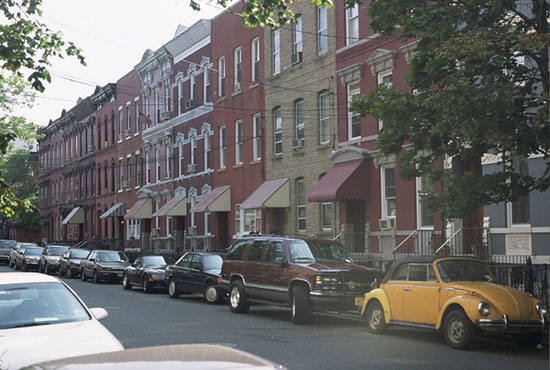
Residential street in uptown Hoboken with turn-of-the-century row homes.
In its early years, the City created four small parks: Church Square, Stevens, Elysian and Columbus. In the decades that followed, the City failed to create any significant amounts of new public parkland. By 1990, Hoboken had the lowest per capita open space ratio of any town in New Jersey. In that year, FBW came out with its plan for the Hoboken waterfront proposing a continuous, public park along the Hudson River unencumbered by private development east of Sinatra Drive. The City adopted this plan for Hoboken’s South Waterfront and by 1997, with the creation of Sinatra Park, Pier A Park and the promenade from Newark to Fourth Streets, it doubled the amount of parkland for the mile-square city.
The City’s original 1990 plan for the South Waterfront called for a 32-story office complex on Pier A and a half million square feet of residential development on Pier C. After the City/Port Authority plan was defeated in two public referendums in 1990 and 1992, the FBW plan with its waterfront parks prevailed. Another important factor in the success of the South Waterfront was extending Col. Stevens’ street grid down to the waterfront thus creating Hoboken-sized blocks and front doors and retail facing the last street and the waterfront park.
Although there have been many opportunities to complete the plan for Hoboken’s waterfront that would make it world class, the City has failed to do so. Sinatra Drive north of Fourth Street is overly wide, making it a by-pass roadway with speeding traffic. The bike path at the South Waterfront dead-ends at Fourth Street. The lush landscaping with rows of trees from Newark to Fourth Street also dead-ends, leaving Hoboken’s central waterfront unfinished and unrealized.
Related links
Col. Stevens’ plan for Hoboken
Plan for Castle Point/Stevens
Mapping & Platting
FBW History
FBW Waterfront Plan Featured